We had an amazing 3 days in Big Bend National Park in 2022. It is an immense park, with more hikes than you could possibly complete in one visit. When our guest author Paul Fuchs offered to share his story of hiking the South Rim Trail in Big Bend, we were excited to have another Big Bend hike for you. Ladona
Located in west Texas, Big Bend National Park is one of America’s most underrated national parks. Due to its remoteness, the park is difficult to reach but rewarding to those who visit. It offers expansive views of the vast, pristine desert and a collection of challenging and rewarding hikes. Big Bend’s most popular hikes include the Santa Elena Canyon, Lost Mine Trail, and Emory Peak. These hikes offer unique opportunities to see the diverse landscapes of the Chihuahuan Desert. People often favor these hikes over the incredible South Rim Trail in Big Bend, which I would argue triumphs over all of them.
The South Rim sits on the southern end of Big Bend’s Chisos Mountains. It takes time and endurance to reach this stunning destination. At a minimum, hikers must complete a 12-mile out-and-back trip to reach the rim. On a hot day, the unrelenting sun can make the hike grueling. Depending on the route taken, the trail rises 2,500-3,100 feet… elevation gain that will test your physicality. Without a doubt, the hike is strenuous. It rivals Half Dome as one of the most difficult day hikes I’ve completed.
Why Hike to the South Rim?
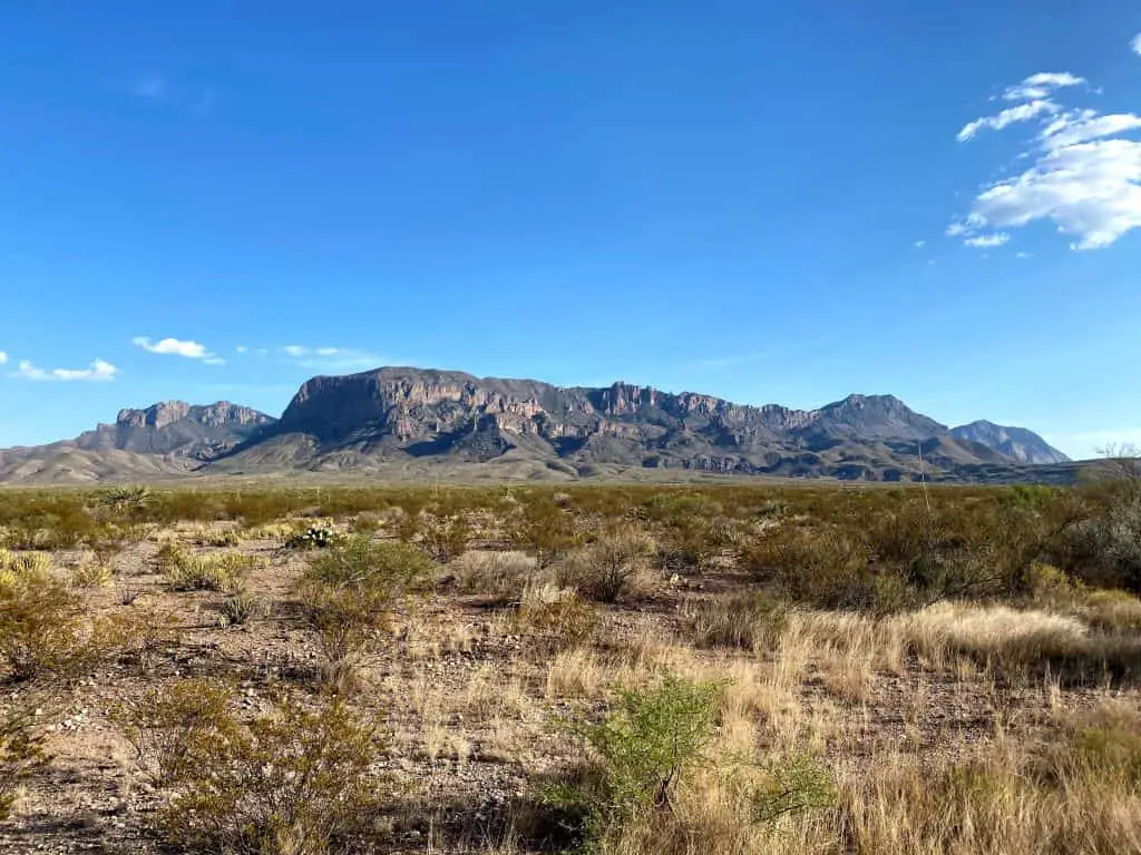
The Chisos Mountains are the most vibrantly-colored part of Big Bend National Park. Hiking to the South Rim allows you to see many of the best parts of the mountains in a single trek. Highlights you’ll encounter during the hike include Laguna Meadow, Boot Canyon, Emory Peak, and views of the Chisos Basin and Casa Grande.
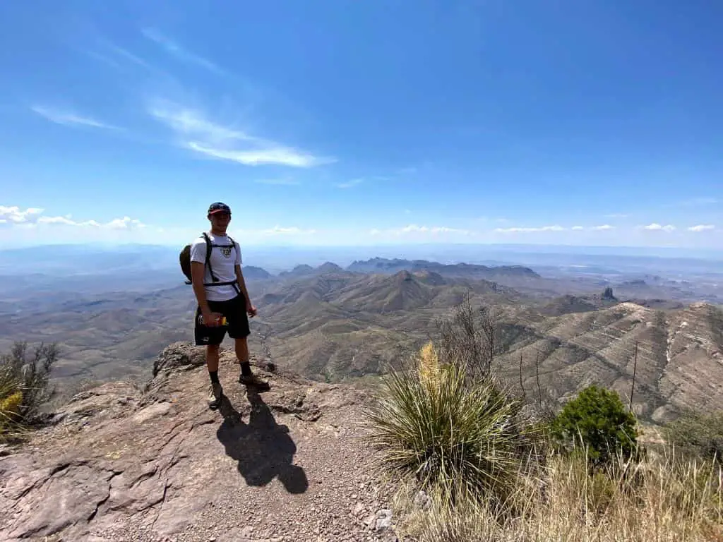
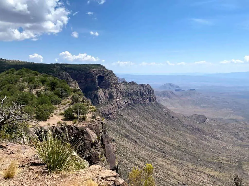
The South Rim Trail itself is stunning. The ground at Big Bend’s South Rim abruptly drops thousands of feet on its way to the distant Rio Grande. The drop-off alone is impressive, and it opens your eyes to an incredible view of the desert. To the south, dramatic landscapes, clear skies, and clean air stretch endlessly.
You could spend hours at the South Rim enjoying the view. It’s easily one of the best views in the park, often overlooked due to the strenuous hike required to reach it.
About Hiking the South Rim Trail in Big Bend
The Chisos Mountains feature an expansive network of trails (as shown by this NPS map), and several routes lead to the South Rim. For the purposes of this article, I will be describing the counterclockwise version of Emory Peak via South Rim Trail and Boot Springs Trail, as mapped on AllTrails.
The route combines the Laguna Meadow Trail, South Rim Trail, Boot Canyon Trail, and Pinnacles Trail. It also includes a detour to Emory Peak, the park’s highest point. The full route statistics are as follows:
- Distance: ~15.5 miles (12.5 miles without Emory Peak side trip)
- Elevation Gain: Approximately 3,200 feet
- Time to Hike: Typically, this hike will take between 8-10 hours with breaks, making it an all-day hike
- Difficulty: Strenuous
- Location: The trail network sits in the Chisos Mountains, at the center of Big Bend National Park
Peregrine Nesting Season Special Alert
During the Peregrin Falcon Nesting season, usually March and April, the Southeast section of the Rim Trail may be closed. In that case, this becomes an in-and-out hike along the western half of the loop. Check at the ranger station and they will show you if and where there are any trail closures.
Preparing for the Hike
The South Rim Trail is one of the most challenging hikes in Big Bend, so it’s important to be well-prepared before starting the hike. Ensure that you understand your own ability and are prepared to hike in the heat before embarking on the adventure.
What to Bring
- Hiking Boots/Shoes: A sturdy, well-treaded pair of hiking footwear is essential to reach the South Rim of Big Bend. You should be comfortable wearing them for a full day of hiking
- Plenty of Water: The rule of thumb while hiking is to bring 1 liter of water for every 2 hours of hiking, and more when factoring lack of tree cover, sun, and steep trails. I completed this trail on a hot day in August, and drank nearly 8 liters of water
- Sun Protection: A wide-brimmed hat, sunglasses, and plenty of sunscreen is essential to combat the lack of tree cover on the trail. Reapply sunscreen at least every 2 hours
- Food: Trail-friendly snacks – dried fruit, nuts, packaged meats, granola bars, trail mix – are essential to keep you energized
- Bear Spray: Black bears, mountain lions, and bobcats live in the Chisos Mountains, so it’s good to carry a deterrent
Where to Go
To start your journey to the South Rim, park at the Chisos Basin Visitor Center. The trailhead sits on the opposite side of the parking lot from the visitor center. The Chisos Basin Campground and Chisos Mountains Lodge are great places to stay to get an early start on the hike.
When to Go
Big Bend is known for its dryness and its heat. The park is the hottest and sees the most precipitation from May through September. Late fall, winter, and spring see the best weather in the park, and consequently the most visitors.
To get agreeable weather and avoid excessive visitors, try to visit the park and complete this hike in April or October. Check the forecast before embarking on the trail, as thunderstorms are common in some months at Big Bend. You do not want to be caught on the trail with lightning overhead.
Start the hike early if you can, between 7-8 AM. Don’t start the hike while it is still dark, as this is when bears and cougars are most active.
A Guide to Big Bend’s South Rim Trail
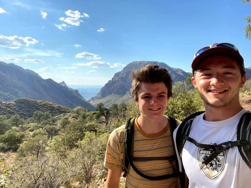
I completed the South Rim Trail in Big Bend National Park on August 28, 2020, during my first visit to the park with my friend Shane. This was during the height of the pandemic restrictions and also during Big Bend’s hot off-season, meaning my friend and I encountered hardly anybody during our trip to the park. It was a bizarre but instantly memorable trip.

Step-by-step directions to the trail with turns and approximate mileages can be found immediately below, followed by my description of the hike and impressions from my visit.
- From Chisos Basin Visitor Center parking lot, begin Window View Trail
- Turn left twice, following signs for Laguna Meadow
- Stay right at first major trail junction and continue for 0.4 miles
- Stay right at trail junction and ascend Laguna Meadow Trail for 3.5 miles
- Stay left at junction with Blue Creek Trail and hike Laguna Meadow Trail for 0.6 miles
- Stay right at junction with Colima Trail and hike South Rim Trail for 2.0 miles
- Stay left at junction with East Rim Trail and hike South Rim Trail for 0.9 miles
- Stay left at junction with East Rim Trail and hike Boot Canyon Trail for 0.4 miles
- Stay left at junction with Juniper Canyon Trail and hike Boot Canyon Trail for 1.0 miles
- Turn left at junction with Emory Peak Trail for 3.5 mile round trip detour to Emory Peak
- After returning from Emory Peak, turn left to descend Pinnacles Trail for 2.6 miles
- Stay right at junction and continue for 0.5 miles
- Return to parking lot via the Window View Trail, completing steps 1 & 2 in reverse
Now, let’s talk about hiking to Big Bend’s South Rim Trail!
Laguna Meadow
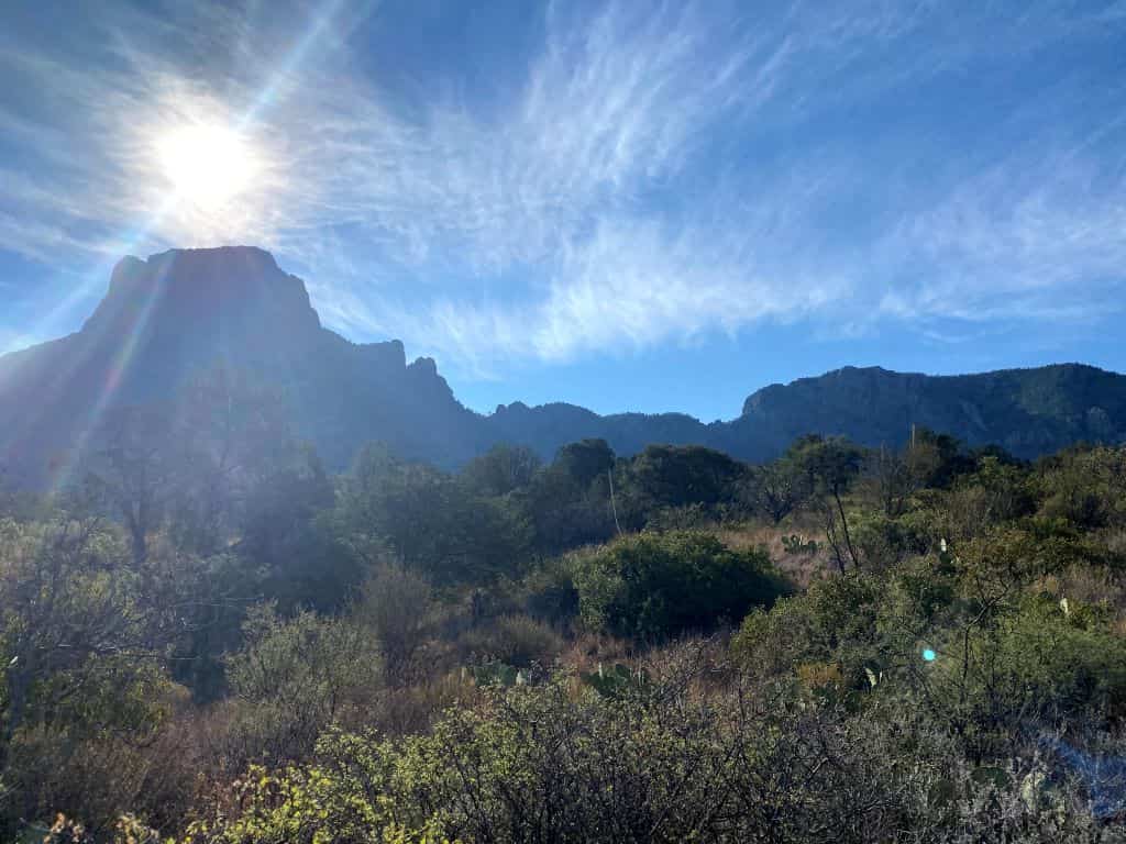
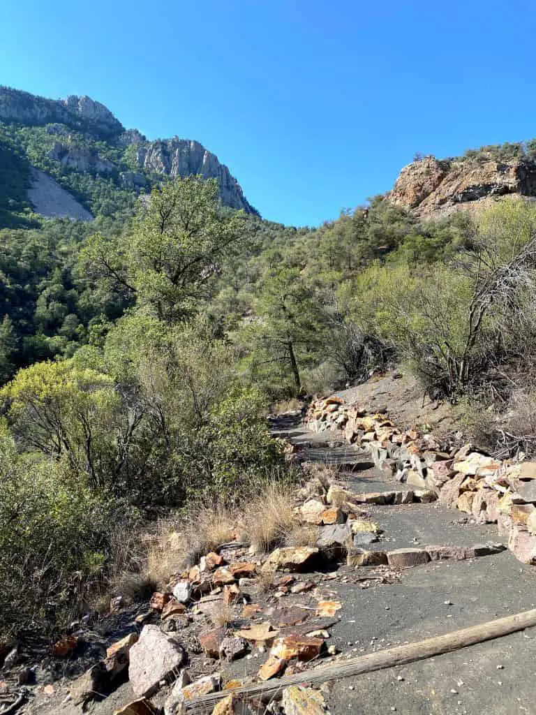
Starting the hike Laguna Meadow Trail winds its way through a surprisingly dense forest – remnants of a forest that has existed since the Ice Age – as it climbs towards a gap in the mountain. While the trees along the trail aren’t very tall, they offer occasional shade and respite from the sun.
This portion of the trail offers some superb views of the Chisos Mountains. If you start the hike early, the morning sun will create beautiful colors as the mountains cast dramatic shadows across the basin. Birds will be chirping, and the forest around you will feel alive with the activity of local wildlife. (It’s obvious why we named Big Bend one of the top 10 National Parks for Birdwatching!)
Once you reach the opening in the mountains before Laguna Meadow, be sure to take a look back at Chisos Basin. Though you might be winded by the constant elevation gain, the view of the visitor center – which will now be tiny – will give you a sense of accomplishment as you embark on the next portion of the trail.
Through the Mountains to the South Rim
After the initial steep elevation gain, the trail mellows out as it passes through Laguna Meadow. Views of the Chihuahuan Desert will peak through the mountains as you navigate slight elevation changes in the trail. In warmer months, wildflowers create surreal scenery as you transition from the Laguna Meadow Trail to the South Rim Trail.
Eventually, you will round a few corners and find the South Rim in front of you. When I encountered this view for the first time, my jaw dropped.
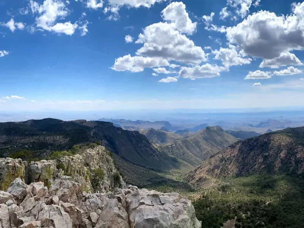
Here, the mountains and forests give way to a mind-blowing view of the Chihuahuan Desert to the south. The clean, unpolluted air allows you to see landscapes over 50 miles away, well beyond the Rio Grande River into Mexico. It’s difficult to find such large, perfectly preserved areas of land in the United States. When I first discovered this view in late 2020, I uncovered a special appreciation for Big Bend. Though some may find the endless desert uninteresting, I found the hauntingly vast expanse of land to be one of the most impressive views found in all the national parks.
The trail follows the South Rim’s cliff line for about a quarter mile. Take your time as you walk along the cliffs, and watch your step! The drop-off next to the trail is severe, so don’t get too close to the edge. Be sure to soak up the stunning view as much as possible and keep an eye out for birds – like the Peregrine Falcon – flying overhead.
Into Boot Canyon
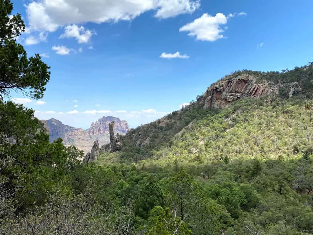
After getting your fill of the view at the South Rim, the trail will begin guiding you back to the north. You will encounter a dry creek bed surrounded by a lush forest, which eventually leads you to a rocky and vegetation-covered landscape. Here, colorful rocks and wildflowers line the trail as the forest thickens and provides welcome shade from the sun.
While navigating the woods, you’ll pass a latrine and a cluster of backcountry campsites. At this point, you’ll begin the Boot Canyon portion of the trail. Before long, the trail will begin traversing the side of a steep hill, and you will catch excellent views of the Chisos Mountains to the north. Trees will continue to shade you from the sun as you gaze upon huge rock spires in the distance.
Boot Canyon to Emory Peak
After trekking through Boot Canyon for a mile, you’ll reach a fork in the trail marked by another latrine and a metal bear box. The path to the left leads to Emory Peak, the highest point in Big Bend National Park. Emory Peak is an incredible hike by its own merits, so you’d be remiss to skip this detour. From the split in the trail, it’s a 3.5-mile round-trip journey to the peak that sees 700 feet of elevation gain. Do not attempt this detour if there are storms on the horizon or if you’re excessively tired. The exposed peak is susceptible to lightning strikes and an exposed scramble near the end can be dangerous if you’re feeling fatigued.
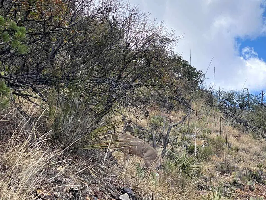
I’ve hiked to Emory Peak twice, once as part of the South Rim journey and once on its own, and both times I saw several deer wandering around the trail split. So, keep an eye out for wildlife here.
After a steady ascent up an increasingly rocky trail, you’ll encounter a brief scramble up some rocks. Then, you’ll find a small weather station and a marker designating the summit. Most importantly, you’ll find another incredible view of the Chisos Mountains, the surrounding desert, and silhouettes of distant mountain ranges. You can even spot the South Rim of Big Bend, where you just hiked from, below you. The view is 100% worth the extra mileage.
Oddly, you might notice a large population of ladybugs atop Emory Peak. I have no idea why these insects are so abundant here, but they were a surprise the first time I summited the peak. Be sure to keep your water bottles and hiking packs closed. You don’t want to accidentally swallow one!
Returning Through the Pinnacles
Once you get your fill of Emory Peak, you’ll begin the long 2,500-foot descent back to the visitor center. The Emory Peak trail deposits you back onto the main trail, which then turns into the “Pinnacles” trail. Aptly named, the steep Pinnacles trail passes through a collection of colorful rock spires as it navigates the side of a mountain.
Along the Pinnacles trail, we discovered an abundance of birds and ground critters among the thick foliage. We spotted the Mexican Jay, Scott’s Oriole, and Acorn Woodpecker flying around and jumping between trees. Squirrels, rabbits, and deer made appearances in the bushes and on the trail as we walked. Though we hadn’t seen another hiker for several hours, the wildlife of the Chisos Mountains kept us company.
Switchbacks cut through massive rock faces that prompted my friend and I to pause and look up in admiration. The late afternoon sun began casting dramatic shadows across Chisos Basin and illuminated the Casa Grande rock formation in a golden light. Though we were exhausted and low on water, the scenery kept us energized during this last portion of the trail.
Finally, after passing a water tank belonging to the Chisos Mountains Lodge, the trail deposits you back at the parking lot. With over 15 miles of hiking, countless jaw-dropping views, numerous encounters with wildlife, and thousands of feet of elevation gain under your belt, you will be ready to kick back and watch the sunset as you relish a successful day on the trail.
After the South Rim
Big Bend National Park remains one of my favorite national parks in the country. Its isolation, incredible night sky, wildlife, and unique ecosystems make it a paradise for those looking to experience nature’s finest offerings. If you’re visiting for the first time, be sure to plan for several days in Big Bend.
I loved hiking Big Bend’s South Rim Trail and I hope to embark on the trail again in the future. If you ever get the chance to complete the hike, come prepared for the challenge and be ready to make some incredible memories. Be sure to bring a quality camera, too. While pictures never do national parks their full justice, it never hurts to try to capture their natural beauty.
Remember to leave no trace, respect the trail, respect other hikers, and enjoy the scenery around you. Happy trails!
If you are planning to visit Big Bend check out our Road Trip to West Texas and New Mexico where we visited 4 National Parks in one week. Ladona
About the Author

Paul is an outdoor enthusiast, amateur blogger & vlogger, and engineer who lives in Indianapolis, Indiana. He began a quest to visit every national park in the United States after a visit to Yosemite in 2018 and has since visited 26… with plans to visit 6 more in 2023. Paul loves to write about his experiences and – since 2022 – has used his website Paul in the Parks to share information that aims to help people enjoy the outdoors safely and respectfully. He spends much of his free time rock climbing, running, cycling, swimming, hiking, and exploring the country with his fiancée, who shares his love of the outdoors.